We’re blessed in Britain to have diverse and iconic landscape locations across the length and breadth of the country. However, most people (particularly those with dogs) know about these fantastic spots, and in some cases, you’ll be rubbing shoulders with a number of photographers at the same spot, with all of you waiting to take a shot as the sun comes up.
However, we’ve all also got our own special spot away from the crowds that we like to retreat to; this spot might be only known to us and could be overlooked by most photographers. In this article, professionals and AP readers reveal their favourite hidden locations around Britain.
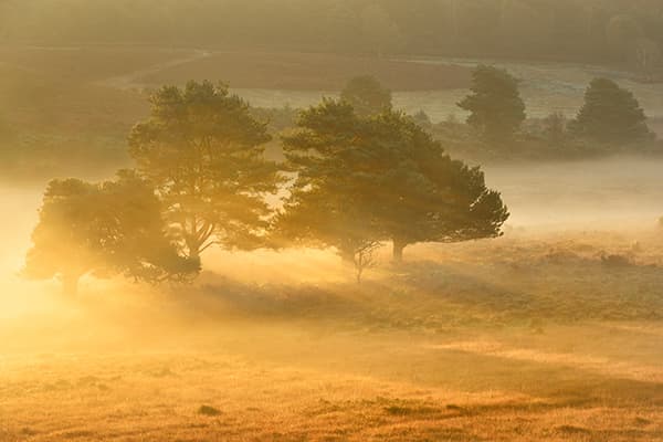
Arne, Dorset
Andy Farrer
Arne has a diverse landscape that’s a real gem
The Isle of Purbeck in Dorset conjures up images of Corfe Castle, Old Harry Rocks, Kimmeridge, Dancing Ledge and Swanage Pier, to name a few highlights. However, on the northern perimeter of the Isle (which is in fact a peninsula), lies Arne – a significantly quieter area with a different ambience to the Jurassic Coast. Arne has a diverse and unusual landscape, packed with wildlife. It is also the site of an RSPB reserve. At Arne you will discover deciduous woodlands, meadows, heathland, marshland, a harbour, a beach, pine trees, ponds, the coastline and panoramic views. It is a gem.
Arne is a lot quieter than other parts of Purbeck and is dotted with deciduous woodlands
The birdlife is abundant, with a number of hides overlooking the harbour towards the wading birds and wildfowl. Ospreys and marsh harriers are also regularly seen. Sika deer are often grazing on the edge of the harbour and easily spotted all over the reserve.
To get to Arne by car from Wareham, drive south over the causeway to Stoborough. Arne is signposted from there. Alternatively, from Corfe Castle, drive towards Wareham and at the first roundabout take the first exit. Stay on the A351, turn right onto Soldiers Road (across Hartland Moor), then right onto Arne Road, where you will reach the RSPB car park at the end of the road. Parking is free for RSPB members or £2.50 for non-members.
Andy Farrer
Lochan Urr, Glencoe, Highlands
Damian Shields
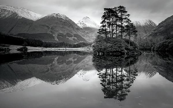
Given its sheltered location, Lochan Urr can often be calm enough to reflect the backdrop
Glencoe provides an extensive range of viewpoints to capture some of Scotland’s most iconic landscape scenes. And there are some hidden gems only a short drive away. The beautiful area around Lochan Urr is just a few miles south of Glen Etive, just past Dalness. You can pull into the lay-by immediately above the lochan, but to avoid the trudge down through thick fern and bracken it’s better to continue to the start of the muddy track that meanders down on the right-hand side of the water.
If you’re prepared to brave some of the trails, the views around Lochan Urr are stunning
Access to some of the better viewpoints from the banks can be challenging, owing to the boggy nature of the terrain, so sturdy boots and waterproof clothing are advised. Thick stretches of gnarly rhododendrons hug the southern and western edges of the lochan, and you might find yourself performing commando-style belly crawls through the undergrowth. The rewards for enduring these trials are many, as the southern vantage points offer a backdrop pairing of Stob Dubh and Stob na Broige. Given its sheltered location, the water’s surface is usually calm enough to reflect the backdrop, giving you wonderful symmetry both horizontally and vertically.

Damien Shields
www.damianshields.photoshelter.com
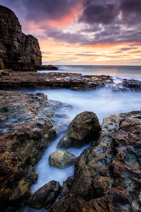
Worbarrow Bay, Dorset
Mark Bauer
The jagged rock stacks at the western end offer great foreground interest
Worbarrow Bay on the Isle of Purbeck is one of the less popular locations for photography on the Dorset coastline, partly because it lies on Ministry of Defence (MoD) land. It is only accessible when the Lulworth Ranges are open, which is usually at weekends and during bank holidays. If you are planning a visit, check www.dorsetforyou.com/lulworth-range-walks.
Lying between Kimmeridge Bay and Lulworth Cove, Worbarrow Bay is accessed from the car park at the deserted village of Tyneham, which is also worth a visit. It is a level walk of less than a mile along the footpath.
The bay has a shingle beach that slopes down to the sea in a similar manner to the beach at Durdle Door. At the western end the jagged rock stacks at Mupe Bay make a natural focal point, and on the eastern flank is a distinctively shaped promontory known as Worbarrow Tout – ‘tout’ being Old English for ‘lookout’. Low tide reveals some interesting rocks, which make great foreground interest.
There are numerous compositional possibilities, shooting in either direction along the beach. Combined with its wonderfully isolated atmosphere, this makes it one of the photographic experiences in the area.
The surrounding cliffs are sandstone, which glow attractively in the evening light, and this fact – together with the south-west orientation of the bay – means that the best time to visit is during sunset in winter. Don’t wait too long after the sunset, though, as the car park at Tyneham is locked at dusk.
Mark Bauer
www.markbauerphotography.co.uk
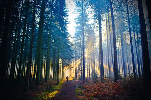
Holmsley, Hampshire
Stu Meech
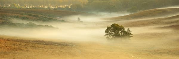
The valley at Holmsley can be a real trap for mist in the mornings
Despite being very close to the busy tourist hotspot of Burley in Hampshire, Holmsley is a much quieter location. I frequently visit the area, but rarely see other photographers, which makes it one of my favourite hidden locations.
The land at the lowest point of the valley is quite boggy and the area becomes a real trap for mist when it forms. In fact, this is one of the main reasons I visit this place, because the mist often forms when the other areas of the forest don’t have any.
To get to Holmsley, travelling along the A35 towards Christchurch, leave the road at The Old Station Tea Rooms and head along Station Road towards Burley. Park at Goatspen Plain car park (50°48’48.4”N 1°40’39.1”W) and walk back down Station Road. The best spots are on the left-hand side.
This view looks into the sunrise and you can often get lovely backlighting through the trees and mist. The area is also surrounded by a lot of heather and bracken, with colour peaking between late August and early September. To catch a glimpse of the mist, visit during spring and autumn – and bring a long lens to take advantage of pony and deer sightings in the area.

Stu Meech
Tetbury, Gloucestershire
Graham Borthwick
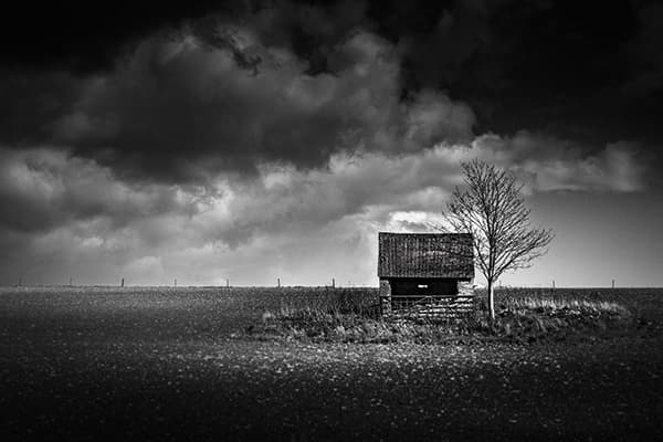
Local spots are perfect to return to over the year to see how the landscape changes
I got this shot by accident when searching for bluebells just outside Tetbury in Gloucestershire, off the A433. This quiet yet open-access area is prime for this type of moody picture, especially when the stormy weather comes to the rear of the rising ground. A wider lens works well. I used a 24-105mm to capture the desolate look, and a chance break in the light gave me this photo.
Access to this location is easy, but it is protected by an old Cotswold wall that is also quite photogenic. The field appears dormant, and I will return later in the year to see if any crops are planted, which will give an alternative view. This will now be my ‘go-to’ location this year to see if I can capture the seasons changing, and it helps that it is close to where I live.

Graham Borthwick
Cresswell Beach, Northumberland
Anita Nicholson
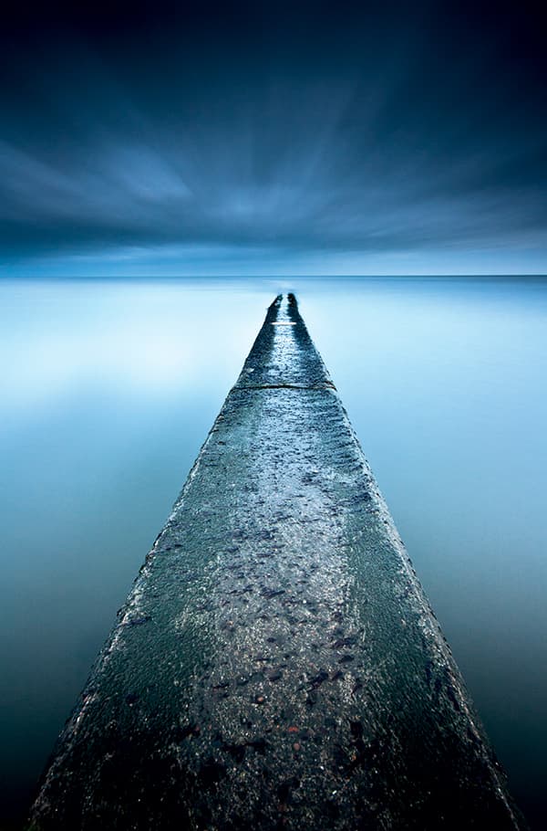
The concrete causeway makes a great subject if the tide is right
Cresswell Beach in Northumberland is a popular spot for local families, dog walkers and fishermen, who love the wide and long expanse of pale golden sands that run from Cresswell village northwards to Druridge Bay. It’s a little off the beaten track for most photographers visiting Northumberland, but is popular for local photographers, especially those looking for wildlife or out chasing the aurora borealis.
There are plenty of other features here for photographers to explore and enjoy. The dunes are expansive, beautiful and quite high in places, offering wonderful views of the long curving bay. There are cube-shaped sea defences dotted along the high-tide line of the beach, which provide fantastic opportunities for seascape photography, especially if there is a lively surf.
Near the village centre, as you descend to the beach, there is a concrete causeway that leads out to a rocky offshore reef, which is home to millions of mussels, other sea creatures and scraps of old wreckage. The concrete causeway itself is a great leading line if you catch it as the tide heads back out about an hour or so after high tide. There are rocks and other treasures to find aplenty, particularly after stormy seas when the pale golden beach can be awash with sea-bleached driftwood and shells.
If you’re planning to pay a visit to Cresswell Beach and are staying for a few hours, then an ice-cream from Cresswell Ices is a treat. Alternatively, if you’re after a coffee, some cake or a full English breakfast, the Drift Café just outside of the village is fantastic and well worth a visit.
Remember that Northumberland has quite a large tidal range, so it’s worth heading to Cresswell Beach for high tide and then allowing yourself plenty of time to wait for features to emerge as the tide recedes.

Anita Nicholson
www.anitanicholsonphotography.com
Mudeford, Dorset
Phil Cooper
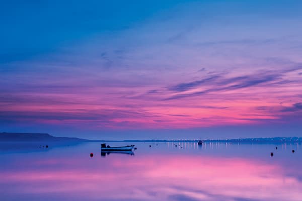
Pay attention as you shoot as the tidal range at Mudeford can be extensive and fast flowing
Straddling the entrance to Christchurch Harbour in Dorset lies Mudeford Quay and Spit. To the east is Avon beach, which is popular with windsurfers, while to the west lies Hengistbury Head, a wildlife and archaeological centre. To the north are the estuaries of the rivers Avon and Stour with the town of Christchurch and its magnificent 12th century priory. A short ferry ride across from Mudeford Quay is the beach hut community on the spit near Hengistbury Head, where huts frequently change hands for considerable sums of money.
There is a small but thriving fishing community based at Mudeford, and the quay is littered with all the normal fishing paraphernalia you would expect, such as lobster pots, nets and floats. If you’re planning on buying fresh catch, there is a stall nearby where the fish can be purchased. There is also a picturesque row of what used to be fishermen’s cottages on the quay The harbour is at its best at low and high tides, and the tidal range can be extensive and fast flowing.
With the sun setting over the harbour behind Hengistbury Head between the months of September and March, this is the best period to capture reflections in the water. For sunrises, Mudeford offers spectacular views of The Needles on the Isle of Wight, over which the sun rises during the late winter months to provide excellent photographic opportunities.

Philip Cooper
Charlecote Park, Warwickshire
Stu Meech
The sunrise is in line with the path for most of the year at Charlecote Park
Charlecote Park is the site of a 16th century country house with a deer park, approximately four miles from the town of Stratford-upon-Avon. The site is managed by the National Trust and is only open during daytime hours to paying visitors. However, there is a public footpath that runs through the bottom of the deer park, and provided you keep to the path boundary you can use it to capture lovely views over the park. I live close by and visit the area regularly.
It’s a hotspot for mist due to it sitting in the lowest point of the surrounding countryside and close to the waters of the River Avon. Using the full length of the footpath, you can get good views of the tree-lined avenue, individual trees around the park, the house itself and the deer that live in the park.
For most of the year, the sun rises in a position relative to the footpath, enabling you to get a suitable side or backlight on many of your photo compositions.
When visiting, I use a little lay-by on the B4086 (Stratford-upon-Avon side of the park) and then walk back down the road in the direction of the park. As the road bends to the right, you will find a gate to the footpath just below the level of the road.
Stu Meech
Sinclair’s Bay, Scottish Highlands
Jeremy Walker
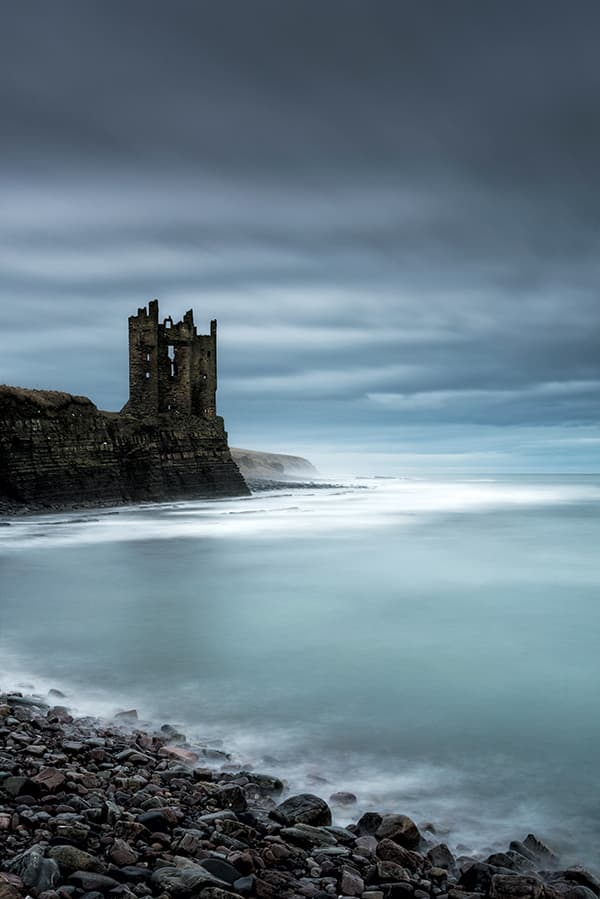
Sinclair’s Bay is best when there are rough conditions with dramatic skies
Sinclair’s Bay in the Scottish Highlands lies just about as far north as you can go in the British mainland to get to a location. It sits 11 miles south of John o’ Groats, and conveys the feeling of being a long way from anywhere – which it pretty much is! Wick is the nearest town just south of the bay.
Sinclair’s Bay is photographically very worthwhile. At either end of the bay there are ruined castles clinging to the cliff’s edges – Keiss Castle to the north and Castle Sinclair Girnigoe to the south – and both are in spectacular locations.
In between the castles is a long sandy bay dotted with the remnants of Second World War defences that are now tumbling into the sea. This was apparently the most landmined beach in the UK during the Second World War. There are also some military pillboxes right on the seafront near Keiss Castle.
Just east of Castle Sinclair Girnigoe, which is three miles north of Wick, is the Noss Head Lighthouse, and although not a spectacular lighthouse there is certainly image potential.
These coastal locations shout out for stormy skies and rough seas, and lend themselves to long exposures, silky seas and blurred clouds. This is ideal territory for the Lee Filters Big Stopper or even Super Stopper filters that can give you exposures of minutes, even on a sunny day, that are ideal for moody shots of the cliff. A sturdy tripod, 24-70mm zoom and a cable release will suffice for these locations. Check out tide times too, as the castles have a different feel and look depending on how high the sea is.
If you want to stay in the area, good accommodation may be hard to find, but try the Forrs House Hotel near Thurso (excellent rooms, great breakfasts) as they have outside rooms, which makes it easier to come and go at unearthly times of the day.
Jeremy Walker
Islay, Inner Hebrides
Niall Benvie
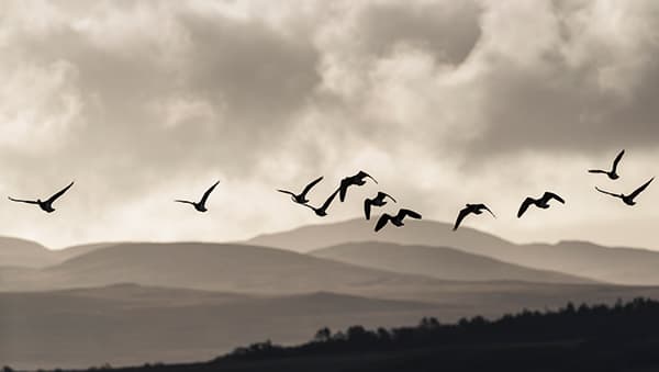
Islay attracts a huge number of wildlife to its dynamic coastline
Islay’s blend of grassland, wild moor and a coastline gnawed raw by the Atlantic makes it an intriguing proposition for the photographer. Rather than diminishing, the cultural landscape enhances the island’s natural wealth. As a result, it attracts a huge number of wintering barnacle and white-fronted geese, and provides a home for many brown hares. The chough, that iconic crow of the Celtic fringes, is present among the cattle on coastal pastures, and even corncrakes have returned to slink between the irises that crowd the damp field edges.
It is on the coast, however, that we find wilderness unmediated by people, where the principal agent of change is the Atlantic Ocean itself. There is nothing between the island’s west coast and Nova Scotia in Canada, so massive waves may hammer into Saligo Bay (my favourite place of all) even on relatively calm days.
The island’s geology and glacial history have given rise to the whole gamut of coastal geomorphology, from cliffs to sandy beaches and mudflats. Rich in texture, form and colour, the dynamic coastline of Islay is spellbinding.
There are some signs of people even here, and several lighthouses, including the unusual square-shaped twin-towered Carraig Fhada Lighthouse at Port Ellen, provide a focus for photography at dusk.

Niall Benvie
www.niallbenvie.photoshelter.com
Sandringham, Norfolk
Jon Clifton
Jon’s shot of Sandringham Country Park one January morning
I moved to Norfolk just over five years ago and find it a county that offers innumerable beautiful places to photograph. Some areas are obvious, such as beaches, quays and windmills, while others are more off the beaten track. This image was taken at Sandringham Country Park early one January morning. The park is 10 minutes from my home and situated just off the A149 (via car or a short bus ride) from King’s Lynn, heading towards Hunstanton.
I’d planned to capture the sun rising through the trees, but it was a bitterly cold morning and I was very close to packing up before the sun started to appear through the mist. The main thing this shoot taught me was that it is vital for a landscape photographer to have patience. After taking a couple of test shots, I set the timed shutter release to 10 seconds and ran into the distance.

Jon Clifton
www.joncliftonphotographyanddesign.co.uk
Landguard Point Felixstowe, Suffolk
Justin Minns

It may not be as glamorous as Southwold along the coast, but Landguard Point still delivers
With the huge cranes of Felixstowe docks looming in the background, Landguard Point in Suffolk seems an unlikely location for landscape photography. But with its old, worn wooden jetties and crumbling concrete, it has been a long-time favourite location of mine for a number of reasons.
Felixstowe is only a short drive from where I live, so it’s somewhere that I can get to quickly if conditions are looking good. There’s a lot to be said for exploring the landscape on your doorstep, as you can visit even when time is short. The more time you spend getting to know a place, the better your images become. Further adding to its convenience, the point juts out into the North Sea in a southerly direction, so one side of it gets the morning light while the other gets the evening light, making it a good spot for a sunrise and sunset.
Most importantly , it’s an interesting area. The shingle spit that forms the point is itself a nature reserve designated as a Site of Special Scientific Interest (SSSI). The relics of old piers dotted along the beach contrast nicely with the modern docks, and I haven’t even mentioned the 18th century fort yet!
To get to Landguard Point, follow the A14 to Felixstowe and at the large roundabout (J60) turn right, staying on the A14. At the next roundabout go straight on towards the town centre, cross the railway line and turn right at the traffic lights on to Langer Road. Turn left at the caravan park on to View Point Road and follow it all the way to the end where there is a car park. From the car park head to the beach and turn left, following the beach to the point.

Justin Minns
The Carneddau Snowdonia, Gwynedd
Kathryn Watson
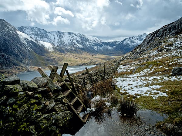
The Carneddau stretches from Conwy to Llyn Ogwen
Snowdon is the highest and, arguably, most popular summit in England and Wales. I sought a quieter, wilder place to walk, scramble and photograph, and so looked north from Snowdon and onto the Carneddau.
The Carneddau stretches from Conwy in the northeast to Llyn Ogwen in the south-west. It comprises sinuous, undulating ridges and boasts numerous summits with magnificent views of Snowdonia. It’s a stunning mountain range and far less populous than its neighbours.
On the day this image was taken, we climbed the north face of Pen yr Ole Wen at the far south-western end of the Carneddau. Initially, conditions were bright, but these rapidly deteriorated and we found ourselves traversing the top scree sections in near-blizzard conditions. Upon reaching the ridge, we ploughed knee-deep through the snow to summit again at Carnedd Dafydd, before descending the south-eastern side of Pen yr Ole Wen towards Tal y Llyn Ogwen Farm.
This image was taken on our descent, looking toward Llyn Ogwen and the snow-draped Glyderau. We stopped at the stile to eat lunch and rejoice at negotiating the mountain and weather.

Kathryn Watson
White Mill Bridge Dorset
Martin Dolan
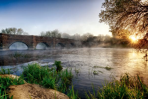
Often cited as the oldest bridge in Dorset, White Mill Bridge makes a brilliant location at sunrise
White Mill Bridge is often cited as the oldest bridge in Dorset. The area is beautiful, tucked away next to the River Stour. Nestled between Sturminster Marshall and the B3082 outside Wimborne, White Mill Bridge is a brilliant location for sunrises and sunsets, each giving you the opportunity to shoot either side of the bridge and capture some of the lovely light reflected off the River Stour.
When photographing at the bridge, I find that using a wideangle lens is always the best choice. It allows me to get close to the bridge and yet capture the length of it while retaining plenty of sky and foreground detail.
Many landscape photographers enjoy capturing a water element in their shots, and I find country river scenes like this one irresistible. To me, it says ‘Classic English countryside’, where the pace of life is that much slower than the modern hustle and bustle of cities.

Martin Dolan
Winspit and Seacombe Dorset
Mark Bauer
It’s no surprise to find that Winspit has been used as a filming location for Doctor Who
Winspit and Seacombe are disused quarries located next to each other on the Dorset coast, about four and a half miles south-west of the popular resort of Swanage. They are both accessed from the village of Worth Matravers, although from different footpaths. You can get to Winspit along a footpath to the south-west of the village, while the footpath to Seacombe starts on the eastern side of the village.
A circular walk is also possible, starting at one location and walking along the cliff path to the other.
Winspit and Seacombe were working quarries until the 1950s, supplying stone for major buildings in London. In more recent times, Winspit has seen occasional use as a film location, notably in the BBC series Doctor Who and Blake’s 7. Once there, it’s easy to see why the makers of Doctor Who chose to film here. Although it’s only a short walk from a picture-postcard village, it has a remote and wild feel to it, with rugged cliffs and threatening, jagged rocks. This atmosphere is enhanced by the fact that large waves regularly crash on the shore. It’s a small cove, and outside of the holiday season you’ll rarely bump into anyone else, which makes it a great place to visit if you want to avoid the more photographed spots on the Dorset coast. It’s best visited at sunrise in winter, not just for the sense of isolation, but also because at this time of year the sun rises over the sea.
There are good viewpoints both from the cliff top and from the shore below, where you can shoot the waves washing over the rocky ledges – although care should be taken, as conditions can get fierce. Neighbouring Seacombe is very similar in character, but is a wider cove, with a little more room to move around.
Mark Bauer
www.markbauerphotography.co.uk
Scale Force Cumbria
David Ball
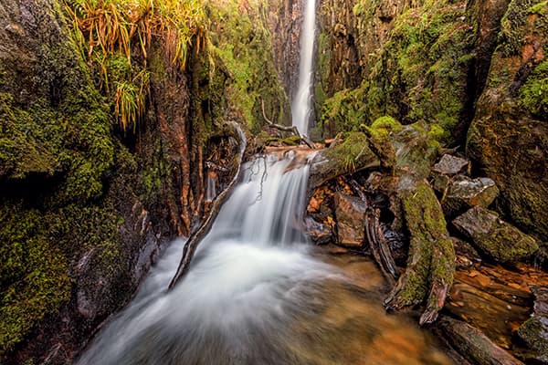
Tucked away in the mountains of the Lake District, Scale Force is worth the arduous climb
I wanted to visit Scale Force waterfall for a long time, but didn’t really know how to get to it. However, after help from a fellow photographer, I set off in pursuit of this magical waterfall, which stands high up in the hidden mountains of the Lake District.
Having trekked around two miles through muddy fields and climbing over everything imaginable, I finally arrived! Once there, I had to scale a 20-foot rock, which was very dangerous and slippery at the time, as it had been very wet the previous day. Nevertheless, all my efforts were well worth it in the end, and as I reached the top, I was greeted with this magnificent view.
What I haven’t mention yet is that when I got up there, the spray coming off the waterfall was the worst I’ve ever experienced, and therefore, I had to be very smart about capturing my image. To get the image I wanted without getting the spray all over my filters, I decided to use my 0.6 soft grad to get the 1-second exposure, which would smooth out the water as it was running so fast. Moreover, with the fast exposure I wouldn’t get any rain dots on my filter and image. For me, this waterfall has to be one of Britain’s best hidden gems.

David Ball